Sale!

Troutmap River Maps Montana – Missouri River

$22.36 $27.95

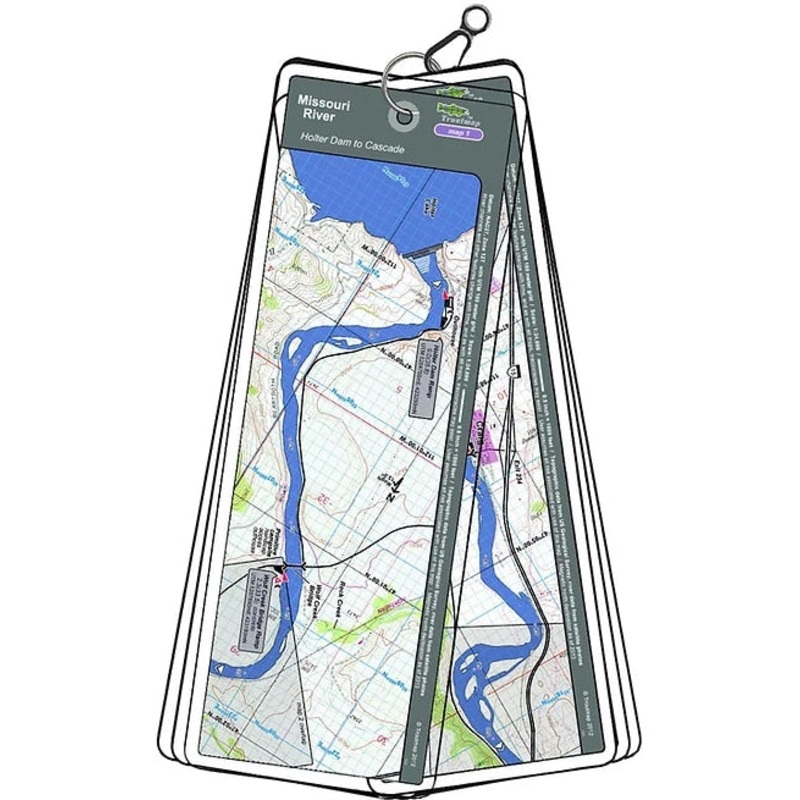
This map set follows Montana's Missouri River for 35.8 miles from Holter Dam to Cascade. This is a big river with nice to trophy size fish and easy access.10 maps and anarea mapProduct Info:Laminated and waterproof maps that follow the river channel.Indivi

Flash Sale Ongoing

00
Day
00
Hours
00
Mins
00
Secs
Event has ended
Color_MT:

This map set follows Montana’s Missouri River for 35.8 miles from Holter Dam to Cascade. This is a big river with nice to trophy size fish and easy access.

10 maps and anarea map

Product Info:

  • Laminated and waterproof maps that follow the river channel.
  • Individual maps are secured with a stainless steel split ring, and includes asnap hook that allows clipping to a cable retractor on waders or boat.
  • Cable retractor is not included
  • River features such as rapids, boat ramps, access points, and campgrounds are clearly shown.
  • Each map set contains an area map showing the general location of fly shops, shuttles, lodging, fuel and places to eat.
  • Approximatesize: printed map:3-3/8 inches by 10-1/4inches;laminated page:3-3/4 inches by 10-1/2inches.

Reviews

There are no reviews yet.

Be the first to review “Troutmap River Maps Montana – Missouri River”

Your email address will not be published. Required fields are marked *